
Mohenjo-Daro
0


Andy Ray
The author of the Uncharted Planet section is an architect and artist, a traveler and researcher, and a proponent of alternative history. Combining professional architectural insight with visual thinking and field observations, he explores ancient civilizations, enigmatic structures, and traces of knowledge that do not fit into widely accepted historical narratives.
According to the most widely accepted view, Mohenjo-Daro—one of the two major centers of the ancient Indus Valley civilization—was founded around 2600 BCE. However, modern research using radiocarbon dating suggests that the earliest cultural layers of the settlement may date back to an even earlier period—around 3300 BCE. I think this isn’t the final theory regarding the city’s origins, since archaeologists try to tie all dates of such findings to official history to avoid falling out of favor in academic circles. The second capital is Harappa, in what is now Punjab.
Modern urban planning. Was Mohenjo-Daro built according to a master plan?
The city had a regular layout, with all streets straight and parallel to each other, intersecting at right angles. Judging by the arrangement of the houses in the Lower City, they formed large neighborhoods, which in turn were subdivided into even smaller ones, organized by the social status and occupation of the residents. This urban layout remains the oldest known in the world. City houses were two-story, with miniature courtyards. Their walls were made of fired brick and additionally coated with a layer of bitumen. The roofs were supported by wooden beams, also made of clay and coated with bitumen. This coating was intended to prevent moisture from accumulating in the houses and spoiling the grain reserves. The city had a well-organized water supply system: canals and reservoirs, both open and underground.
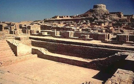 The image depicts a large-scale ancient archaeological site in a dry, desert-like environment under a bright, cloudless blue sky. In the foreground and middle ground, there are well-preserved stone structures including wide steps, paved areas, low walls, and the foundations of numerous rectangular rooms built from large beige and reddish-brown stone blocks. The ruins ascend a hillside, culminating in a massive, distinctive circular stone tower (or fortified structure) at the top of the hill, which dominates the entire landscape. The architecture suggests an ancient fortified settlement or citadel.If there was a sewer system, then there must have been a water supply too!
Mohenjo-Daro was likely the first place in history where residents built a sewer system reminiscent of a modern waste disposal system. Waste from each house flowed through gutters into underground channels that emptied beyond the city limits to a huge cesspool. Apparently, the residents placed particular importance on hygiene, as among the most significant buildings excavated at Mohenjo-Daro was a large public bath in the center of a paved courtyard. Craftsmen's workshops and shops were located along the main streets. In the western part, on a hill (the Upper City), stood a citadel where residents could hide during an assault on the city walls. A brick pool approximately 2.5 meters deep was constructed within it, intended, archaeologists believe, for ritual ablutions. Various structures, the purpose of which can only be guessed at, lined the citadel. There was also a substantial grain storage facility. This type of storage of this vital food product could indicate that grain—perhaps part of the harvest—was a public good. Some researchers identify certain buildings with temples, palaces, or educational institutions, but these are merely speculative theories. A spacious hypostyle (columned) hall, known as the Assembly Hall, stood apart, apparently intended for city meetings. Its total population was at least 40,000. It is surprising that, with such overcrowding and a hot climate, the city survived for so long without succumbing to an epidemic.
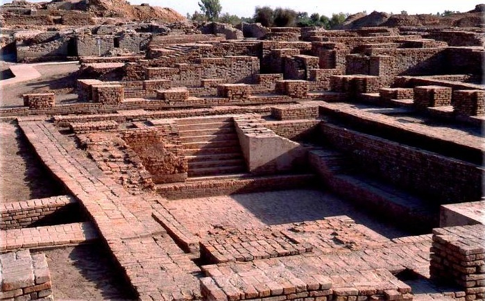
The ruins of Mohenjo-Daro had previously attracted little interest from scholars. It was only in 1922 that they were first explored by the Indian archaeologist Rakhal Das Banerjee (1885-1930). He is considered the discoverer of this ancient city of pre-Buddhist culture. He also pointed out its similarities with another ancient city, Harappa. This, in turn, led to the discovery of the previously unknown Indus Valley civilization of the Bronze Age and made it possible to roughly determine the geographic boundaries of its distribution. Before this discovery, the independence of the civilization in this region was long denied, and it was considered an eastern variant of Sumerian culture. It turned out that the area of the Proto-Indian culture is larger than the area of the Mesopotamian and Egyptian civilizations combined: it stretched 1,600 km from south to north and 800 km from east to west. The pottery and household items show signs of standardization; in addition, numerous weights and stamped seals have been found, indicating standardization and centralized control in the commercial sector. After the catastrophe, no one lived in the city, which already distinguishes Mohenjo-Daro from Harappa, where people were settling again.
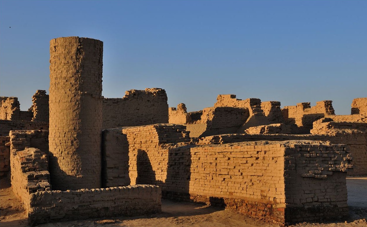 The image shows impressive ruins of an ancient desert fortress constructed primarily from sun-dried mud bricks (adobe). In the left foreground stands a prominent, tall cylindrical tower with thick walls, showing signs of erosion from time and harsh desert conditions.The Mystery of the Downfall of Mohenjo-Daro
Mohenjo-Daro does not appear to have declined as a cultural center gradually; by historical standards, its demise occurred almost overnight. There are various theories regarding the reasons why this happened. According to a number of researchers, the most famous of whom was the English archaeologist Mortimer Wheeler, the inhabitants of Mohenjo-Daro were wiped out during the Aryan invasion. These theories are linked to passages from the *Rigveda*, which describe Indra and his divine fire destroying the fortresses of the Aryans’ enemies. However, the hypothesis that the Harappan cities were destroyed by an Indo-European invasion is difficult to reconcile with the fact that, over nearly a decade of excavations across the vast site of Mohenjo-Daro, fewer than forty skeletons have been found, and some of them apparently date to periods when the great city had already been abandoned. If the Aryan invaders had taken it by force, there should have been far more remains of the dead. Moreover, further studies of the skeletons conducted in 1994 showed that the “injuries” on the skulls were not injuries at all, but traces of erosion. It is noteworthy that among the ruins of its many structures — all built according to a single plan — no palaces or temples have been found. Its writing system remains undeciphered, and the mystery of its demise has not been solved. It is still unclear what suddenly brought about the downfall of this great city. A widespread theory holds that the destruction of Mohenjo-Daro was caused by a nuclear explosion. Evidence cited includes melted stones, the aftermath of fires, and an exceptionally powerful explosion. Traces of melting at temperatures well above 1000°C have been preserved on stones within a 400-meter radius of the city's center. Supporters of the theory that a powerful explosion was the cause of Mohenjo-Daro's destruction point to the description in the ancient Indian poem, the Mahabharata, of the explosion, followed by a blinding celestial radiance and "smokeless fires." The Mahabharata also describes how the high temperature caused the surrounding waters to boil, and "the fish looked like they were burnt."
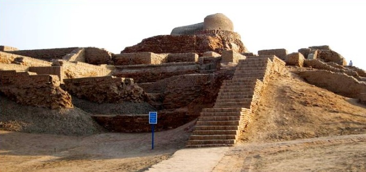 The image shows one of the most iconic views of the Mohenjo-Daro archaeological site (Indus Valley Civilization, circa 2500 BCE) in present-day Sindh, Pakistan. In the center-right, a wide, well-preserved brick staircase ascends the large mound (citadel). At the top sits a rounded, dome-shaped Buddhist stupa, which was built much later (around 2nd century CE) on top of the ancient Indus Valley remains. The entire hill is covered with eroded reddish-brown fired brick structures, terraces, and walls. The foreground features a dirt path and a small blue informational sign. The scene is set in a dry, arid landscape under bright daylight.A natural cause for the city's destruction?
In support of the traditional account, Russian chemist Dmitriev put forward a “natural” catastrophic theory, which he published in the late 1980s in the journal *Vokrug Sveta*. This hypothesis explains the city’s destruction as a natural phenomenon linked to a high natural concentration of plasma, similar to ball lightning. Dmitriev suggested that thousands of “cold” and active ball lightning discharges formed simultaneously in the atmosphere above the city and exploded all at once. It seems to me that the theory of the simultaneous formation of thousands of ball lightning discharges in the atmosphere seems more fantastical than the scenario of a nuclear explosion. What do you think?
These days, many are beginning to realize that ancient epics and legends are not fairy tales, but descriptions of real events that took place on Earth many thousands of years ago. Note that references to the “punishing heavenly fire of the gods” are found both in the ancient legends of pre-Columbian America and in the ancient Sumerian epics known as the “Laments.”
In my book *War of the Gods*, I referred to the Indus Valley civilization as the “Empire of the Sacred River Valley.” In my opinion, it was one of the oldest civilizations on Earth. In the second book, which I am currently writing, I want to focus in more detail on the final catastrophe that practically destroyed all ancient civilizations and set humanity back several thousand years in its development.